
Issue 2026-042
 Ethiopia
 Rwanda
 South Sudan
 Sudan
Sudan
 Uganda
[Draft] Hydromet Flood Bulletin
Draft prepared Monday, October 12, 2026 10:54
Bulletin valid from Oct 12, 2026 10:54
to Oct 16, 2026 10:54 EAT
Ethiopia
Rwanda
South Sudan
Sudan
Uganda

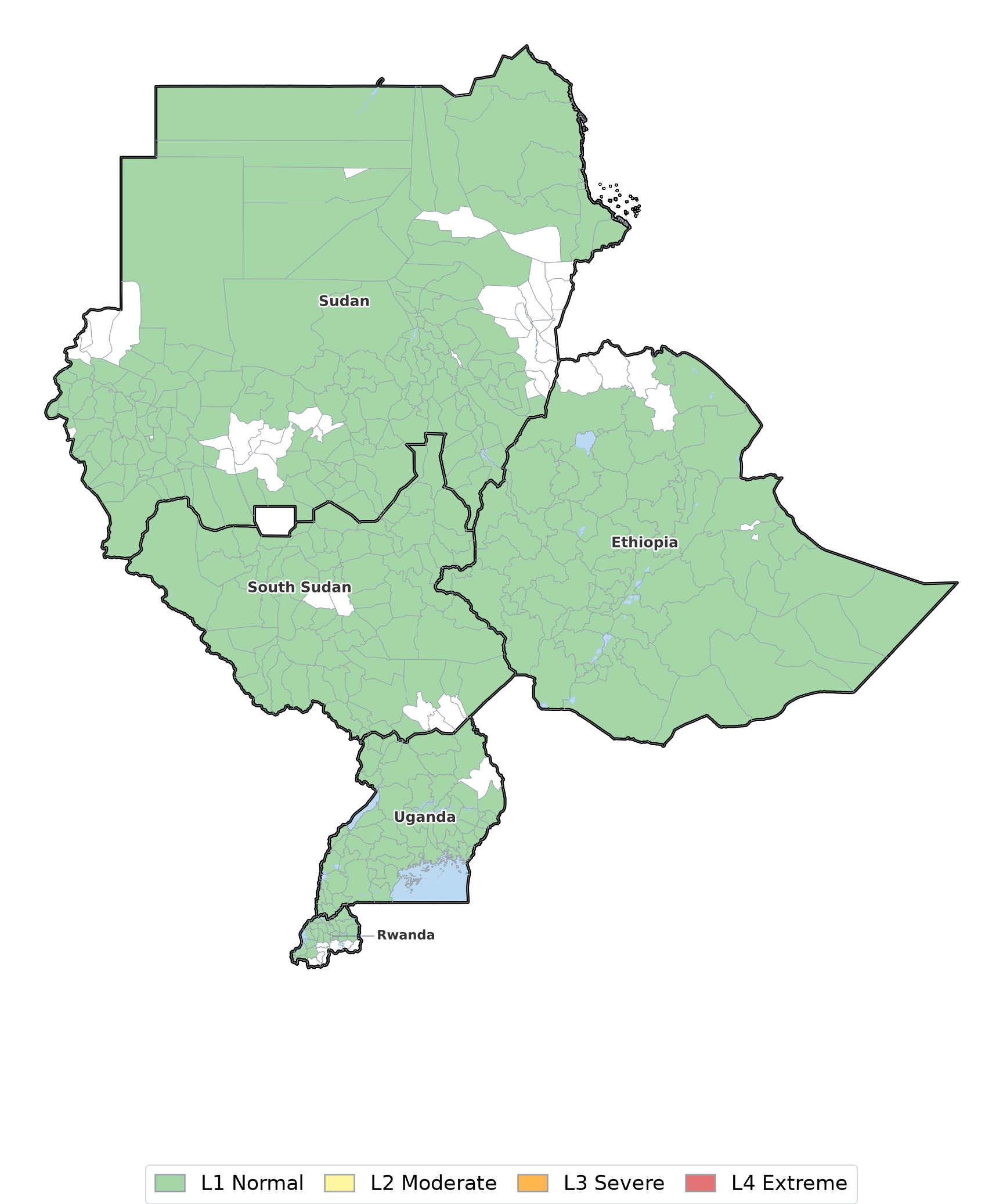
1. Rainfall Forecast
2. Riverine Flood Forecast
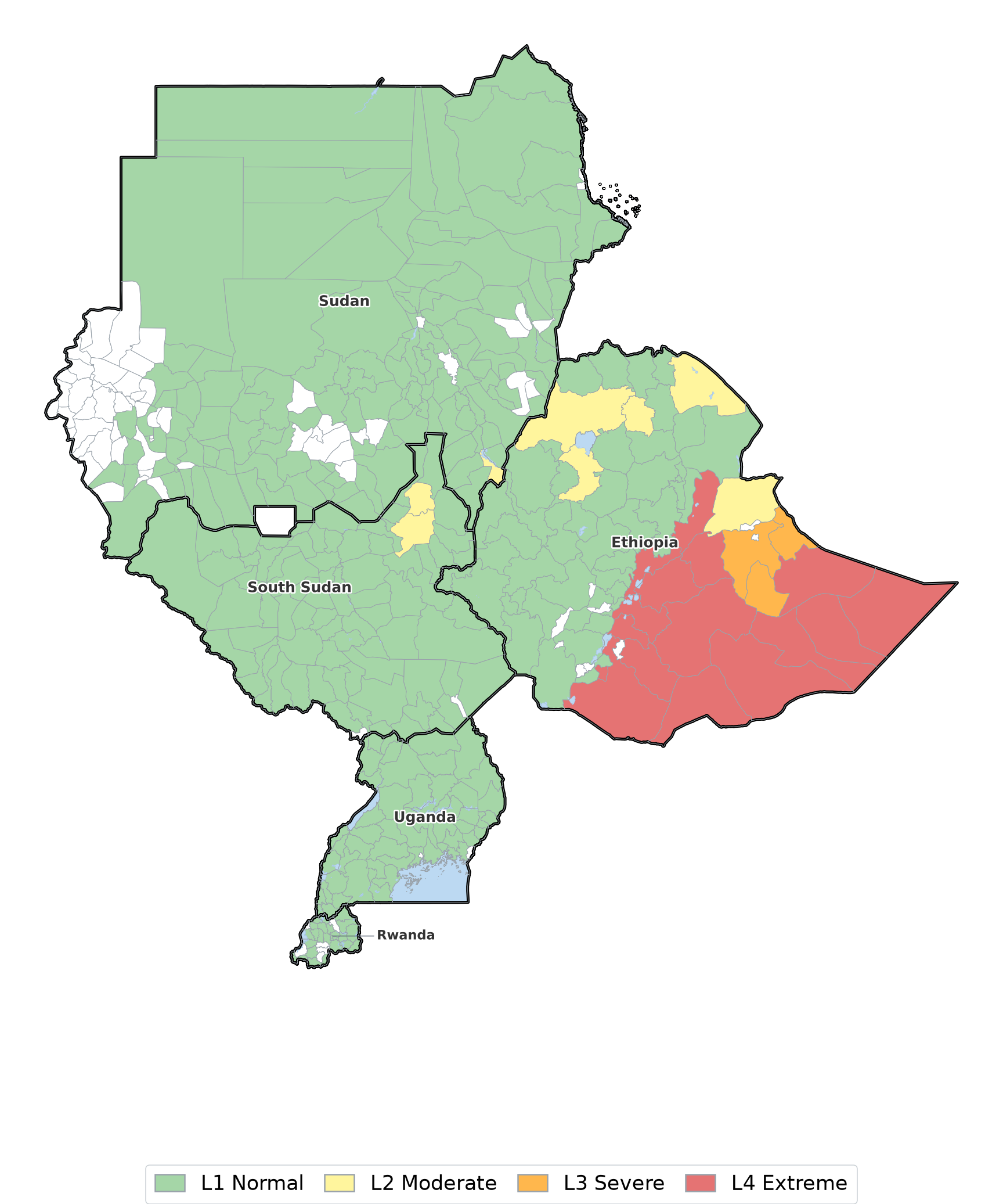
Riverine Flood Forecast Summary
Sudan
Riverine flood risk reaches moderate level in Geissan. Expect elevated river and surface-water flow, affecting riverine settlements, crossing points and irrigation intakes along the reaches concerned.
South Sudan
Riverine flood risk reaches moderate level in Baliet, Melut. Expect elevated river and surface-water flow, affecting riverine settlements, crossing points and irrigation intakes along the reaches concerned.
Uganda
River and surface-water levels stay within their normal range across every admin area this window — none of the 350 forecast points monitored exceeded its 90th-percentile discharge: crossing points, irrigation intakes and low-lying farmland are not expected to be affected.
Ethiopia
Riverine flood risk reaches extreme level in Afar Zone 3, Afder, Arsi, Bale, Borena, Burji. Expect elevated river and surface-water flow, affecting riverine settlements, crossing points and irrigation intakes along the reaches concerned.
Rwanda
River and surface-water levels stay within their normal range across every admin area this window — none of the 55 forecast points monitored exceeded its 90th-percentile discharge: crossing points, irrigation intakes and low-lying farmland are not expected to be affected.
3. Combined Flood Forecast
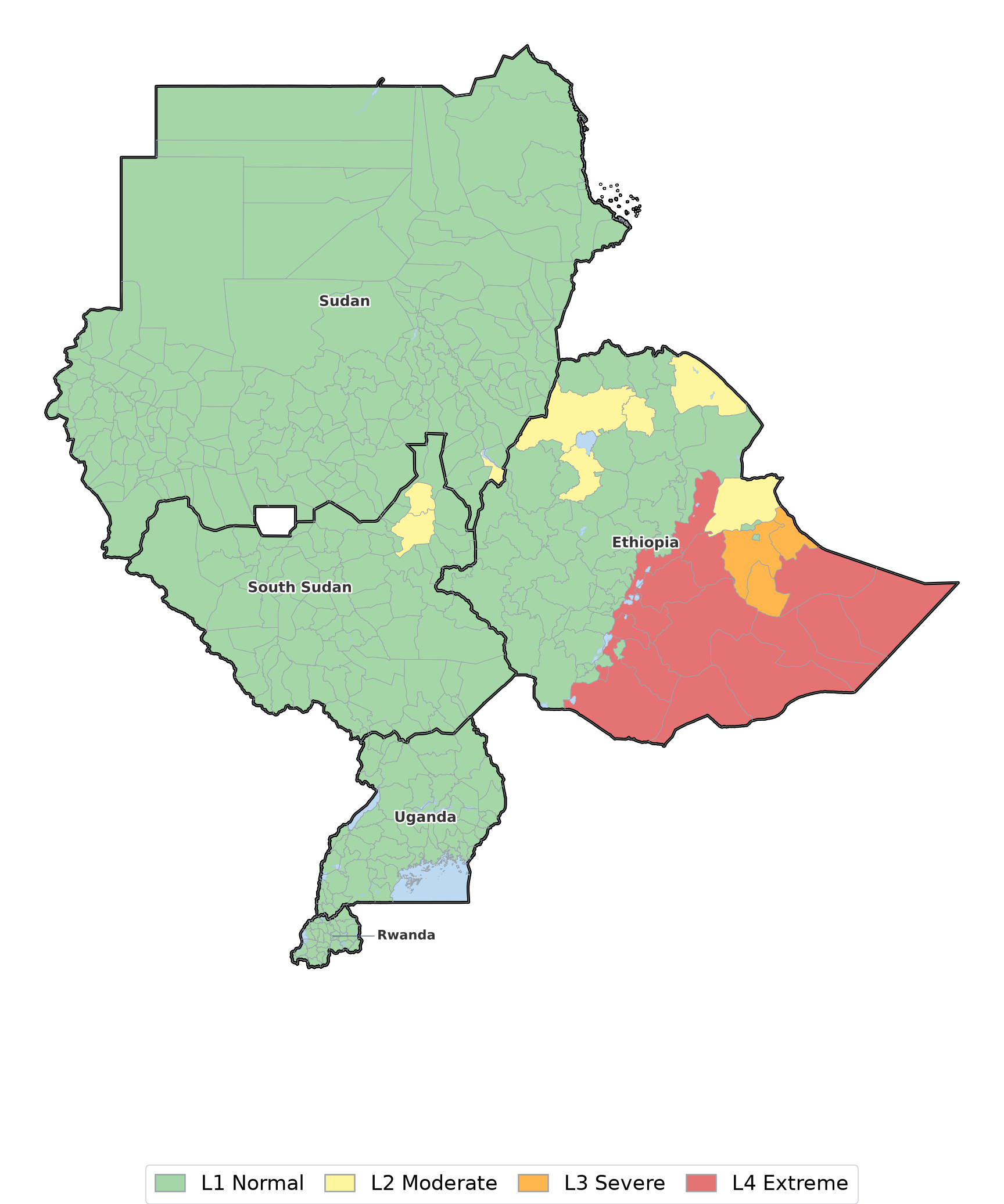
Combined Flood Forecast Summary
Taking rainfall and river response together, combined severity reaches extreme level over Afar Zone 3, Afder, Arsi, Bale, Borena, Burji. These are the areas where both signals agree, so they carry the strongest case for early action this window: disaster management actors should treat them as the priority for pre-positioning and community messaging, while agriculture, food-security and water actors should assume disruption to field access, market movement and surface-water supply.
| Severity level | L1 Normal | L2 Moderate | L3 Severe | L4 Extreme |
|---|---|---|---|---|
| What it means | No flood impact expected. River and rainfall levels are within their normal range. | Localised flooding possible in low-lying and poorly drained areas. Disruption likely to be short-lived. | Flooding likely to affect settlements, farmland and crossing points. Damage to property and access is expected. | Severe and widespread flooding. Danger to life, livestock and infrastructure; displacement is likely. |
| What to do | No action required. Continue routine monitoring. | Stay informed and follow updates from your national meteorological and hydrological service. | Pre-position resources, review early action triggers and warn communities in exposed areas. | Activate response plans, move people and livestock from flood-prone areas and follow instructions from national authorities. |
WHCA partners & collaborators
 WMO
WMO
 UNDRR
UNDRR
 Netherlands Red Cross
 IFRC
IFRC
 SMHI
SMHI
 CIMA Foundation
 Ministry of Foreign Affairs of the Netherlands
This Regional Hydro-Meteorological Bulletin is produced by the National Meteorological and Hydrological Services (NMHSs). Any recommended actions or response measures must be validated and coordinated through the designated national focal points of the relevant meteorological and hydrological authorities in each country.
Rainfall Forecast Summary